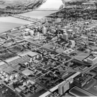
Aerial View of Louisville including the Ohio River, 1957
Dublin Core
Title
Aerial View of Louisville including the Ohio River, 1957
Subject
Aerial Photographs; Cities & towns; Bridges; Ohio River
Description
A black and white image depicting an aerial view of downtown Louisville, the Ohio River, and Southern Indiana with two bridges visible.
Date
1957
Contributor
Caufield and Shook
Format
image/jpeg
Still Image Item Type Metadata
Original Format
photo
Files
Collection
Citation
“Aerial View of Louisville including the Ohio River, 1957,” History of the Parkland Neighborhood, accessed April 27, 2024, https://exhibit.parklandhistory.org/cms/items/show/67.

